Category Weather
Oh, geez (rain forecast)
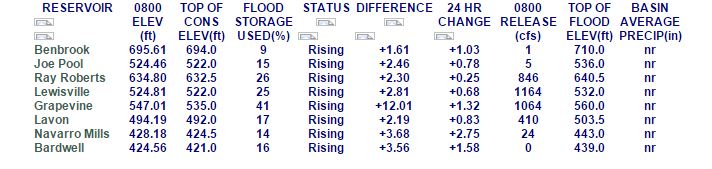
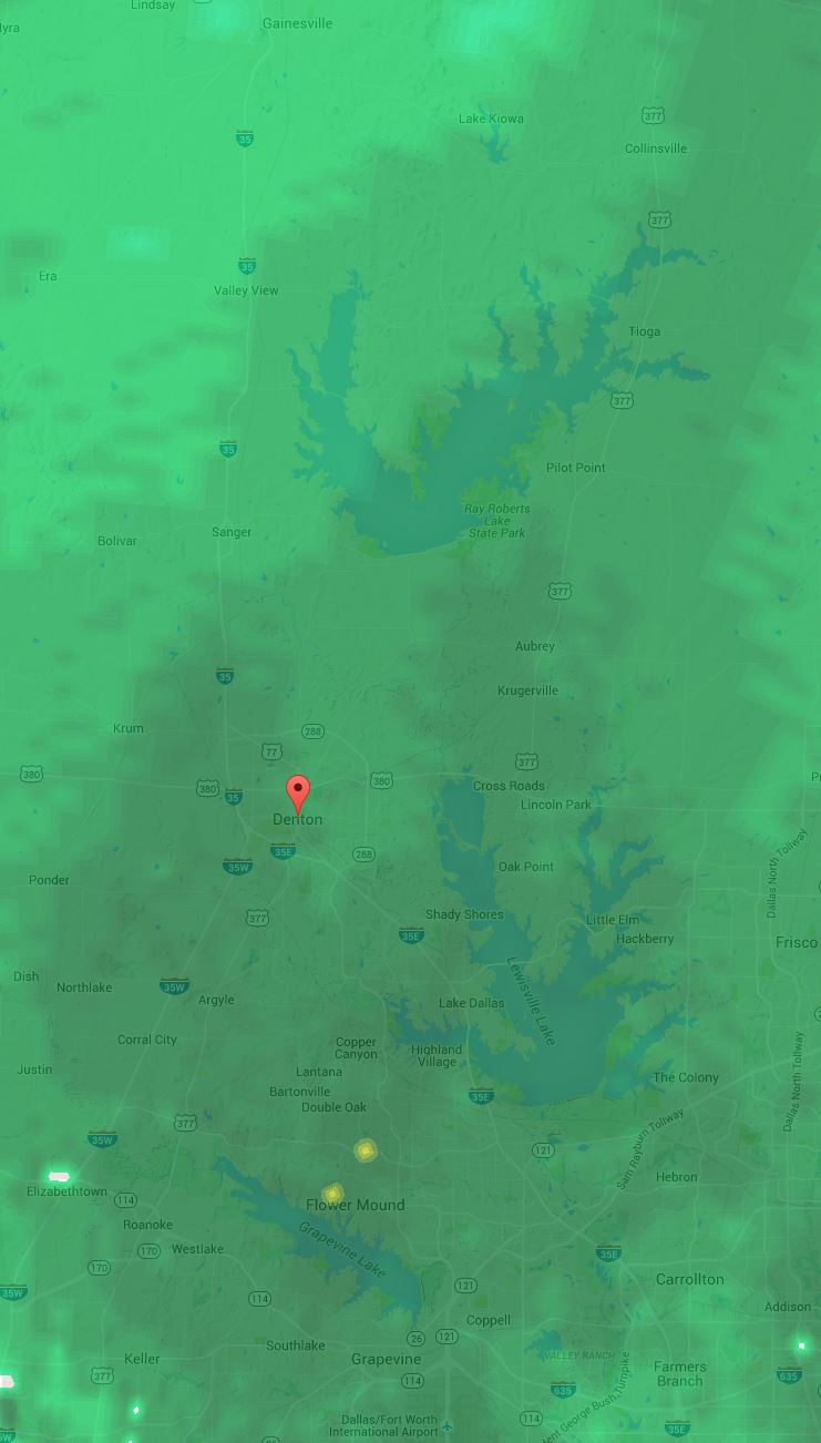
Lake Levels and Rain
Lake Lewisville sits prettily at conservation levels.
Lake Level: 522.35′
Feet above Conservation Pool: 0.35′
Feet under Flood Pool: 9.65′
Corps is releasing 1,686 cubic feet per second
Of course, there’s a bit of rain on the way….
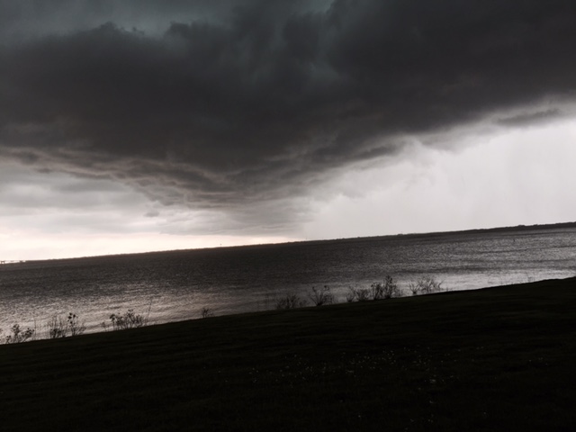
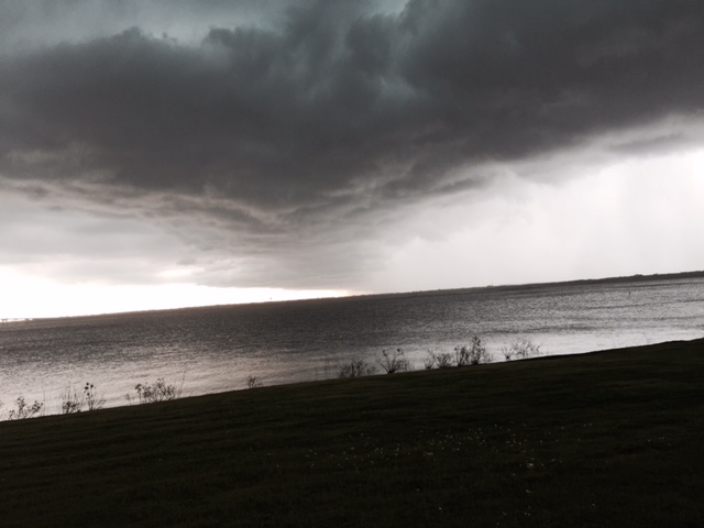
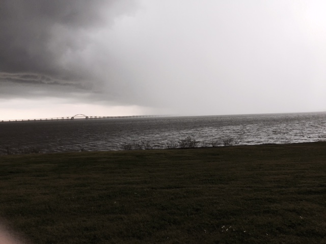
Storm images
Tim captured some gorgeous images of the storm on Monday, April 11, 2016.

From Tim Kraft

From Tim Kraft
From Tim Kraft
From Tim Kraft
From Tim Kraft
Rising lake levels
Lake Lewisville rising after recent rains.
Lake Level: 524.88′
Feet above Conservation Pool: 2.88′
Feet over Flood Pool: -7.12′
Corps is releasing 1,167 cubic feet per second

Lake levels between January 1 and March 10

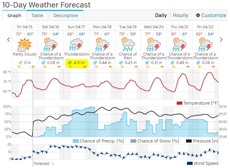
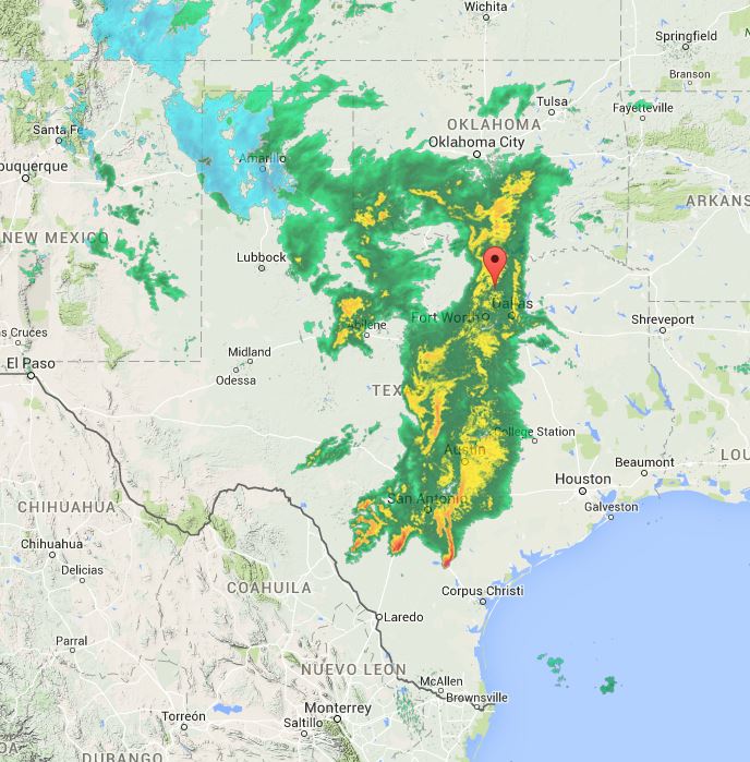
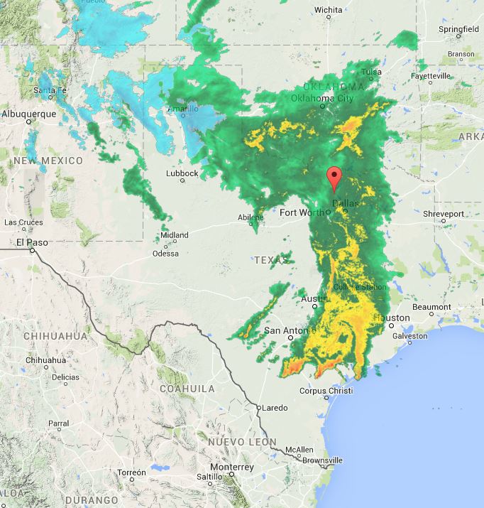
Rain in Forecast
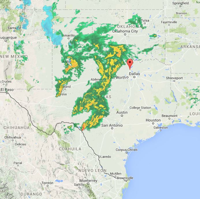
Ain’t no thing.
1 AM
2 AM
4 AM
2:30 PM, February 23
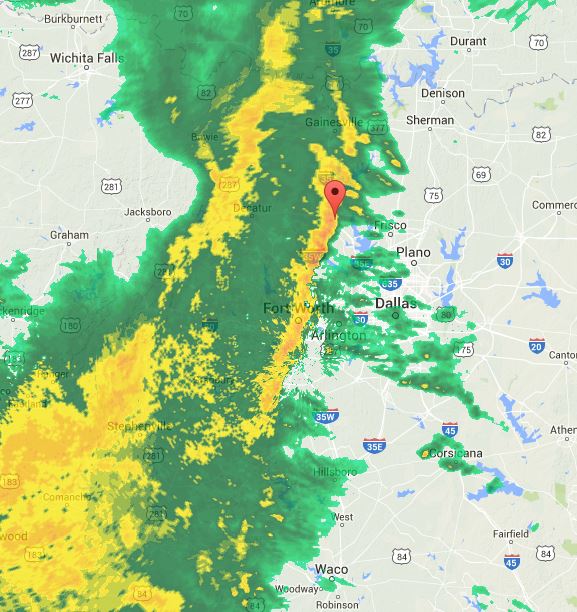
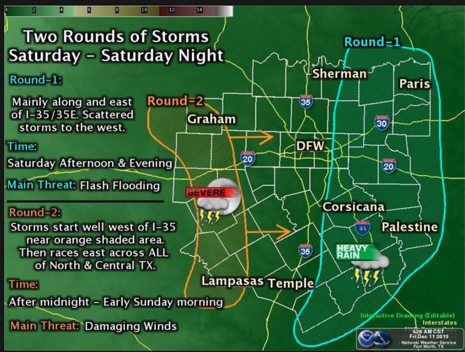
Threat of Damaging Winds
From our friends at the National Weather Service:
“Two rounds of storms expected across North and Central Texas Saturday through Saturday Night. The main threat associated with the first round of storms is heavy rainfall and flooding. The main threat associated with the second round of storms is damaging winds.”
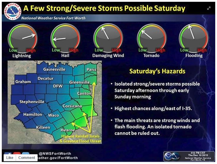
Weekend Weather
From our friends at the National Weather Service
Lake Lewisville remains high after recent rains.
Lake Level: 529.97′
Feet above Conservation Pool: 7.97′
Feet over Flood Pool: -2.03′
Corps is releasing 6,366 cubic feet per second
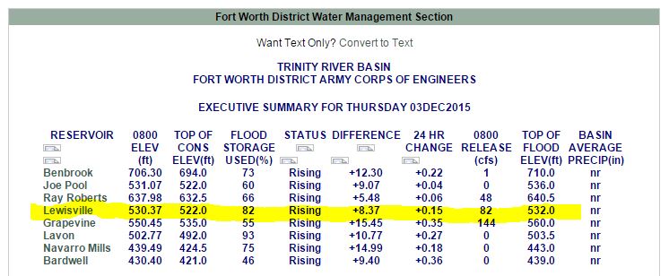
Water levels still rising, just not as quickly
Lake Lewisville remains 8.37 feet above conservation pool, but still 1.67 under the flood pool. For the moment, the water is still rising, albeit slowly.

Water Levels from January 1 to December 1, 2015
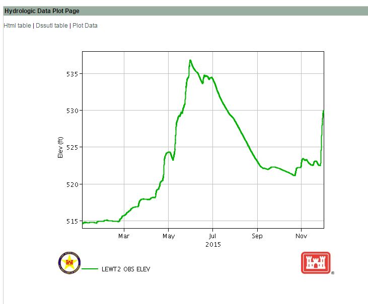
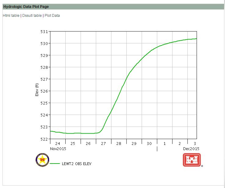
Water Levels in November, 2015

Rising Water
Flooding (again)
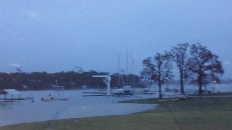
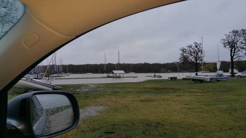
Thanks to the following members for the images:

Courtesy of Kristin Lyon
Courtesy of Kristin Lyon

Courtesy of Suzanne Glorioso
Courtesy of Suzanne Glorioso

Courtesy of Suzanne Glorioso
National Weather Service on tornadic activity
From the National Weather Service Fort Worth office:
Flagpole


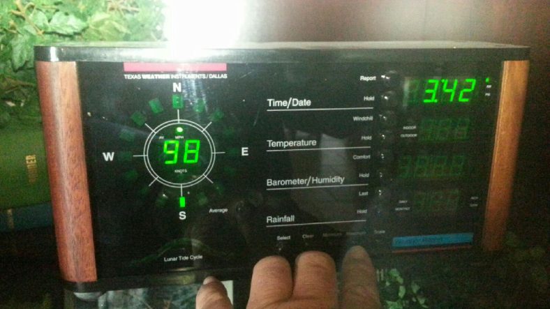
Max Wind Report from Patterson’s Instruments
“El Niño behind storms to come”
Texas could see very heavy rains, with the worst of the weather in eastern Texas and the central Gulf Coast, “but that doesn’t mean there won’t be instances [of severe storms] farther west in the Dallas area,” Noll said. “You’ll have these storms move through and they’ll drag some significant cold fronts with them.
“You’ll see severe weather outbreaks in November and into the winter.”
Northern Texas could see more ice and snow than normal, with cold air pushing as far south as the Rio Grande Valley, Noll said. Places like Corpus Christi can expect lots of gray skies, drizzle and low clouds through the winter months.
If El Niño brings a series of significant rainstorms to the Dallas area, as it did in late spring, officials at the Army Corps of Engineers in Fort Worth said that the lakes and river should be able to handle it.
Denton Record Chronicle, “El Niño behind storms to come”
By Michael E. Young
The Dallas Morning News
Published: 15 November 2015 11:59 PM
